


WinGPS™ Marine

WinGPS™ Marine介绍
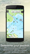
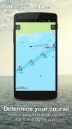
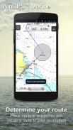
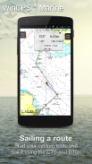
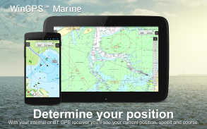
WinGPS Marine 为您提供现代、易于学习的导航工具,确保您的安全旅行。长按图表即可绘制您的路线。船上的 GPS 将显示您的确切位置。将海图下载到您的设备上,然后使用最新的海图离线划船。通过 WIFI 连接您的 AIS 并防止可能的碰撞。
由 Stentec 开发,用于海上、潮汐和内陆水域的帆船和机动游艇、单桅帆船和独木舟的导航。租用或包租船只时的理想选择。
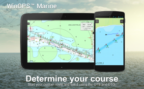
• 支持内陆航道绘制西欧和多瑙河图,包括桥梁、船闸和航道信息。有了这个,您可以快速绘制和调整路线,指示任何障碍。旅途中将显示水道名称和距离。
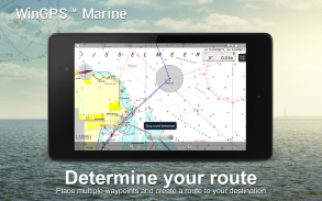
• 智能标签可防止文本标签重叠(也包括水道),以获得最佳图表图像。桥和船闸数据始终可在 Course Up 旋转海图上读取。
强调
• 浏览Stentec、Imray、NOAA 和Delius Klasing 的最新图表。
• SD 卡支持图表存储。
• 管理航迹、图表、路线和航点。
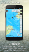
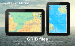
• NOAA World GRIB 文件:风、气压、降雨量和温度。
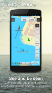
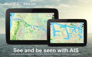
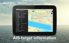
• 通过无线WIFI 或蓝牙连接连接AIS 和GPS。
• 防止与AIS 船舶的速度矢量发生碰撞。
• 人员落水按钮有助于营救失踪的船员。
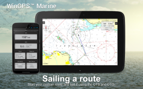
• 图表沿着中心GPS 位置下方移动。 NorthUp、CourseUp(海洋)或 HeadUp(Plus)。
• Harmoniemodel KNMI 提供详细的天气预报(另外,仅限荷兰)
• NOAA 公海波浪预测(Plus,全球)
首次安装 WinGPS Marine 时,这将是功能有限的 WinGPS Marine Lite。非常适合作为带有 GPS 支持的图表查看器。
在应用程序内购买
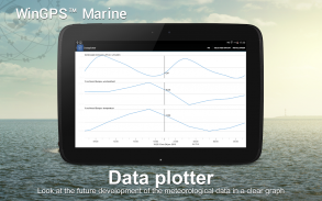
购买 WinGPS Marine 后,您将解锁个人导航系统的全部功能。您现在可以绘制路线、下载 GRIB 文件、保存以前的轨迹以及连接 AIS 和 GPS。使用方便的时间表查看预测的风、雨、气压和 AIS 目标。
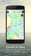
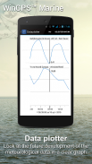
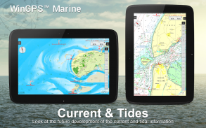
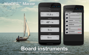
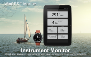
通过 WinGPS Marine Plus 升级,您将能够通过无线连接将其他船上仪器连接到您的船上 PC、多路复用器或 AIS 应答器。您可以在数据绘图仪中显示海流和潮汐信息或在海图上查看。此外,还支持先进的 KNMI Harmonie 天气模型以及 NOAA 全球气象模型。
KUSTFIJN Getijmodel Rijkswaterstaat 可以根据风力预测瓦登海、艾瑟尔湖、马克梅尔、兰德梅伦和泽兰的海流、潮汐和水位。红色深度线根据深度、潮汐和风的偏差来限制安全水道。
图表覆盖范围和安装图表
当您启动 WinGPS Marine 时,您将自动看到 ESRI 的(在线)默认地形图。您还可以打开美国 NOAA 图表并通过图表管理器下载免费的世界图表
为了安全导航,您可以在 www.stentec.com 上购买数字海图。您还可以在应用程序中或通过 Google Play™ 购买图表。您的图表可以安装在 3 种不同的设备上。例如,在 Android 平板电脑、手机和 Windows 笔记本电脑或计算机上。
在 Marine 应用程序中使用您的 Stentec 帐户登录,然后在图表管理器中下载或更新您购买的 DKW2 海图。
例如,流行的 DKW1800 系列每周更新一次 BaZ,而 NL 图表则每两周更新一次。我们的在线商店提供最新的海图和西欧的所有内陆海图,包括多瑙河。
更多信息:
www.wingpsmarine.com
隐私政策:
www.stentec.com/en/en/privacy-statement
用户输入
为了改进应用程序,我们对您的体验和建议非常感兴趣。请发送电子邮件至helpdesk@stentec.com。
WinGPS™ Marine - 版本4.76
(23-04-2025)
WinGPS™ Marine - APK信息
APK版本: 4.76程序包: com.stentec.wingps_marine_liteWinGPS™ Marine的最新版本
其他版本


同类应用


